The events I am about to share with you took place between 10:24am on April 29
th and 2:44pm on May 3rd. That was supposed to sound like the beginning of the show 24, by the way.
For those of you who don't know, Stewart Island is located south of the south island of New Zealand. Most of the island is a nature reserve, but there is one town on the island, called
Oban. People who live in
Oban joke that Stewart Island is the south island of New Zealand, the south island is the north island... and there is some other island somewhere. According to Maori legend, Stewart Island is the anchor by which the canoe (south island) of some god is tethered. I believe this legend because Stewart Island is definitely made of stone... and lots of mud.

To get to Stewart Island, one must either fly or take a ferry from Bluff. Island locals say you can choose between 15 minutes of terror or an hour of hell.

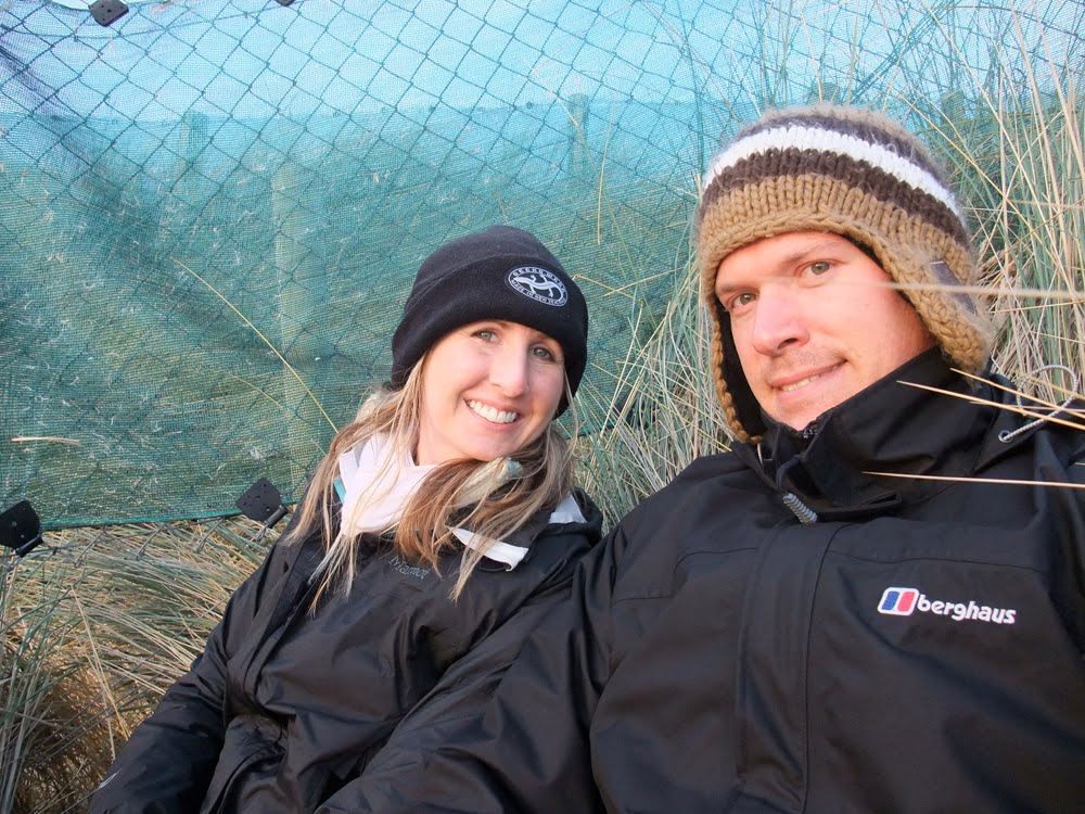
We chose the latter. This was our boat. It looks pretty cool, but we were quite green by the end of the ride. It was funny because we were originally reading guide books and I think we both realized, at the exact same time, that we needed to focus on the horizon or face certain stomach contractions. We decided the books could wait.

Needless to say, we were happy to get back on solid ground... although it did feel like the ground was moving for a while. This is what
Oban looks like. There are only a few roads and everything is in walking distance if you have the time. Almost everyone burns coal for heating and you can smell its ambiance as you stroll the streets.

After an hour or two, we had our appetites back and I am excited to tell my mom (if I can ever find a ground-line phone) that one of the cafes had melting moments for sale!!! I have to say my mom's are still better, but it was interesting to see a different interpretation of that model of cookie. I liked the sandwich idea though; you can never lose by adhering two cookies together with frosting.

This little fish n' chips stand was recommended to us by two locals independently so we knew it was something we needed to try. The main reason for urgency was due to the fact that the stand was closing down for the winter in two days. Since we were going to be on the
Rakiura Track by then, this was our only opportunity to have the freshest fish n' chips EVER! It was delicious for sure.

We were then treated to yet another beautiful sunset! I like the sun beams coming down through the clouds.

The day before, we met the nicest lady, named
Ulva (who was named after the island), who also runs a company that gives guided tours on
Ulva Island– a small island located in
Halfmoon Bay. We told her what we were thinking of doing while on Stewart Island and she pretty much planned the entire trip for us. Our first full day was very long, but very excellent. We started out meeting our guide, Matt, and taking a boat taxi over to
Ulva Island.

Just a reminder: New Zealand has no indigenous land mammals. As a result, most of the animals in the country are birds. These birds evolved few defenses against the mammalian
predators that have been introduced by Europeans (both accidentally and deliberately) and are hurting on the mainland as a result. On Stewart Island, though, these predators exist in far less numbers due to more successful trapping. This is why their kiwi population is so high. So high, in fact, that you can even see them in the day time even though they are a nocturnal bird. On
Ulva Island, predators are nonexistent with the exception of about two rats that are trapped per year. As a result, you can find a far more diverse bird population than on the mainland. We saw a
saddleback, the rarest bird in the country, numerous times during our visit on
Ulva Island.

This is probably the cutest bird we saw. The New Zealand Robin, which is not related to the North American Robin (which is a thrush), forages for worms, grubs, and other invertebrates by buzzing the ground with its legs fooling its prey into thinking that it is raining and time to surface. Since they are so used to being predator free,
Ulva Island birds are very tame. The Robins exemplified this the most. They were very curious and would fly around us a lot. They normally follow land birds around and take advantage of their ground-stirring feet. When we saw a robin, we would scrape the ground with our shoes to expose the dirt. They would fly down and use that bare spot to search for food.
This video shows the bird buzzing its feet in a spot we just scraped. It looks like it is doing a funny jig.
Our island tour took us to Boulder Beach where there are a number of
Weka families. I think, as a result of people leaving their bags unattended,
Wekas have learned that bags contain food. This
Weka was very interested in this lady's camera bag. I love how it stretches its neck to see what's inside. They are cute!

Once we got back to Stewart Island,
Ulva had arranged so that Terry picked us up and drove us in her "tuck-tuck" to the beginning of the
Rakiura Track, where we would backpack for the next two nights.

This chain sculpture is at the beginning of the track, but can also be seen as you leave Bluff. It keeps Stewart Island from floating away.

The track follows the beautiful coast of the island. Just like
Ulva said, we would have nice weather for our bird watching tour, but it would rain when we got to the track. She must be psychic!

There are a lot of rickety bridges you must cross along the track. This particular one wasn't that bad.

The first hut we stayed in was the Port Williams Hut. It had a pretty grass yard right on the ocean, a large bunk room, and a kitchen with running water. The outhouses were located in the back.

Here, Andrea is making her bed. They have mattresses, but no sheets or pillows. You just plop your sleeping bag down on a mattress and fall asleep.

Here I am making some mac n' cheese on my camping stove. Most people just use their stoves on the kitchen counter. My stove is so hot that I have to hold the pot above it.

We met a nice group of Americans (and one Canadian) who are studying abroad at
Otago University in Dunedin. We played a game similar to Asshole called 13. Having never played before, I won the first game. Then, Andrea won the next ten games. I'm sure they were regretting inviting us to play with them.

We had a pretty morning and good weather. We went searching for kiwis the night before, but were unsuccessful.

This is what most of the trail looked like between Port Williams and North Arm. You walk on a boardwalk which is better than trudging in the mud (which is what we did a lot of the next day).

There is a small lookout tower you can climb and get a beautiful panoramic view of the island. Here we are breaking the rules and both standing on the tower at the same time... don't tell anyone who works for DOC.

This is a picture of us discovering the North Arm Hut. It wasn't as nice as the Port Williams Hut, but it was still good.

Here I am posing like a late 1800s explorer.

When we got back from the
Rakiura Track, we had the pleasure of staying at Andy and Jo's bed and breakfast, which is highly regarded in Lonely Planet (and for good reason too). It took a while to wash all the mud off of our boots and pants. Then, Andy did our laundry for us. Andrea had a sock stolen by the underpants gnomes.


Andy and Jo's home is not large, but very cozy, but it is their warm, friendly hospitality that makes your stay so delightful. The two are originally from the states, but Jo inherited the Stewart Island property from a family member and they have been running a B&B for over 25 years. I gathered that there is only three rooms for hire and one bathroom with the toilet separated in the back of the house. Andy told me that back then, properties were worth more when the toilet was not connected to the rest of the bathroom.

Here Andrea is enjoying breakfast of freshly baked bread the night before, jam, butter, muesli, yogurt, eggs, and fresh fruit juice. The dining room is so small I couldn't even fit my leg under the table, but I didn't mind. The food was too good! Andy makes the breakfast all by himself. He and Jo are so nice, you can sit in their living room and talk for hours if you have the time. I wish them the very best :)

The next day, we had several hours to kill before we took the ferry back to the mainland. Here we are sitting in the cafe above the ferry terminal. It had already closed for the winter, but made a nice place to sit and rest. We were pretty exhausted and sore from the Rakiura Track.

 We stayed at a DOC site the night before and had the entire site to ourselves... or so we thought until we realized there was another campervan nearby when we awoke the next morning. It was NZ$6 for us to stay there and you pay by putting the money in a small envelope and sliding it into a slot. We didn't have exact change so we were trying to decide between paying nothing and hoping DOC people didn't check the next morning, or paying NZ$10. Luckily we did the latter because the next morning we were greeted by two smiley DOC officials who made sure we camped legitimately.
 These deer are kept in a fenced-in area near the beach that the Moeraki Boulders are located. You can buy deer food in the shop nearby and feed the deer. I just put my hand out and one of them licked it to Andrea's disgust.
 Believe it or not, this picture was taken at 10:45 am. The sun sure stays low in the sky now!
 Unlike previous attempts, I was able to defy the dangers of standing on a large stone sphere and achieve perfectly vertical form.
 This is my attempt at looking like a super hero– Wolverine, I think.