Thursday, August 26, 2010

Mt. Iron Walk with Andrea and Milly

While working at a ski resort, you would think you would get plenty of exercise skiing, but unfortunately, there isn't much free time in my department for ride breaks. I end up skiing one day a week on my weekends, but I average less than that since the snow has been so bad this year. Andrea and I are having to resort to walking to get our exercise. If our walks end up being as fun as this walk, we will definitely have no problem exercising from now on.

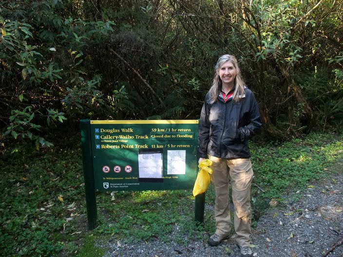
I think I may have done a blog entry about Mt. Iron already, but I will talk about it some more: Mt. Iron is a small mountain that towers over the east side of Wanaka. The walking path, which goes up one side and down the other, is very popular due to it's ease and it's proximity to the town. The view from the top also makes the trip worth it.

Just to add some difficulty to our walk, we decided to walk to Mt. Iron, not drive. It was a really pretty day so we felt inclined. This picture was taken on Aubrey Rd in the construction zone where they have built a foot path. A lot of the city has no sidewalks, which makes commuting by foot muddy. As we walked, we passed houses with dogs in the yards barking at us. There was one dog that had been locked on a second story balcony, which was a great place for it to bark at us from. We also passed many well-behaved dogs too and we talked about how great it would have been to have our own dog for a day, just to make the walk more fun.


At the foot of Mt. Iron is Allenby Park which is probably used for Football (Soccer) or other children's sporting events. We had to walk through the park in order to get to the Mt. Iron path and were delighted to meet a friendly border collie with no owner in sight. She seemed happy to see us and we were quite happy to see her. She was very curious and interested in us and rocked her head when we asked her where her owner was and whether she had a toy we could all play with. I decided it would be really fun to play fetch with her in the park so I started looking for a stick. Border collies are so smart; I swear she knew what I was looking for and she helped me search.


Andrea and I spent about 45 minutes throwing the stick for the dog and playing keep-away with her. She had a really funny way of playing with us. When she would fetch the stick, instead of giving it to us right away, she would stand so the stick was just out of reach. When we would lunge to grab it, instead of running away, she would just take a few steps back to keep the stick inches from our grasp. She would act uninterested in us, but still be measuring our distance from the corner of her eye.


She would even maneuver the stick in her mouth so that there was a long end that invited our grabbing attempts. After several of our failed attempts at recovering the stick, she would make it easier until one of us was eventually allowed the privilege to throw it for her again. She did not play tug-a-war, though; grabbing the stick sent her dashing down the field to retrieve it again. This game went on and on until we were both tired and ready to continue on our walk. We made a friend, indeed.


The dog's owner was nowhere to be found. We checked her tags to see if there was a phone number, but they only contained immunization records. From that point on, she followed us on our walk. She was our dog for the day– just what we had wished for.


As she followed us, she never wondering too far away. We named her Milly because I thought she looked like a Milly. She looked at us, puzzled, when we called her that name so we knew it wasn't right. We wished Milly could have told us her name– her eyes would meet ours as if she were ready to speak to us, but then she would dash into the woods, fueled by curiosity. As we walked up the mountain, we came across many other dogs, off lead, and Milly couldn't have been better with them. The last thing I wanted was for her to cause trouble and for Andrea and me to be blamed for the behavior of our supposed dog.


Here she is checking out the ancient rock formations meant to thank the gods for letting us climb on their sacred mountain.


Andrea tried to get a picture of me with Milly, but she wouldn't come to me when I called her so we had to time it so she was in the background.


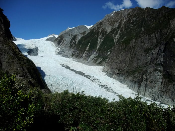
Here is the view of the Wanaka township from the top of Mt. Iron.


On the way back down the mountain, Milly found another stick she wanted to play with, but we didn't throw it for her because we didn't want her to accidentally tumble down the mountain side.


As we neared Allenby Park, we worried that Milly's owner would never show up and that she was going to follow us all the way home, but we were wrong. With perfect timing, her owner drove by with an open window calling, "Come Gracie!" It was a delightful treat to learn her real name! He parked his Subaru Outback in his driveway down the street, which was located next to the Mt. Iron walking path. This explains why she seemed to be leading the way up the mountain on our walk. I'm sure she has done the hike countless times. Her owner called her again from down the street. She seemed conflicted; she wanted to stay with us, but knew she had to obey her master. Immediately after this picture was taken, she trotted off, down the street, and back home. If only she knew how fantastic she made our day.

Thank you, Gracie.

Friday, August 13, 2010

Treble Cone

After almost two months working at Treble Cone ski resort in Wanaka, I think it's about time I share this amazing place with all of my millions and millions of readers.

This is the beginning of the road up the mountain to Treble Cone. New Zealand ski resorts differ from most North American and European resorts in that they don't take up the entire mountain. Since New Zealand mountains are lower in elevation (the base of the Treble Cone mountain is somewhere around 1200 ft), the ski resort must start halfway up the mountain in order to get snow. The upside is that you don't have to live in the freezing cold snow; Wanaka doesn't get much snowfall in the winter. The downside is that, since the resort only takes up the tops of the mountains, there is much less skiable area to enjoy (about 550 hectares compared to Copper Mountain's 985, for example). It also makes for some amazing views from the resort.


In this picture, you can see how most of the surrounding mountains don't have snow on them. After a large snowfall, they will only be covered on the top half. Lake Wanaka is also really beautiful when seen from Treble Cone. It is almost always calm and makes for some amazing mountain reflections on sunny days.


This picture was taken from the stairs on the base building. You can see some of the parking lot, the meeting area for ski school, and the beginner's platter with the Palmer lift. The lower part of the mountain is for beginners and is free to use for all ages.


We are not having the greatest snow this season. It sounds like they had a lot more at this time last season. On the front of the mountain, a lot of snow must be made to keep the groomed runs covered. You can see in this photo how the mountain surrounding the Treble Cone boundaries is still green.


Something else that happens a lot around here is an inversion layer of clouds, which the lake seems to influence somehow. When the atmospheric pressure is high and we get easterly winds, we have overcast skies in town and around the lake, and sunny blue skies up on the mountain.


Working on the mountain requires us to wake up early in the morning, and we have seen some amazing sunrises from the mountain.


This is the building that contains the cafeteria, the staff room, the ticket offices, snow sports sales, rentals, and the bar/cafe. You can see the parking lot and road attendants in the green vests. They help the cars park in a coordinated fashion.


This picture was taken one of the first mornings I was working in one of the ticket sales windows as I was waiting for customers to show up and buy tickets. Can you feel the anticipation as I nervously waited, unsure about my ability to sell the products effectively?

Fortunately, almost two months later, I feel very comfortable in my job and I feel as though I perform well too.

Saturday, June 12, 2010

Pancake Rocks

Our next stop while traveling up the west coast was the pancake rocks. I must admit that I hadn't done my research so I was expecting something completely different than what we actually saw there. I also had no idea where they were until I eventually passed several signs advertising their approaching location. That being said, the pancake rocks are one of the countless wonders of the country and undoubtedly worth stopping for. How they were formed is still a scientific mystery, although they know they are some kind of sedimentary rock. Sedimentary rock is formed on the ocean floor as shells, minerals, and muck settles to the bottom over millions of years. As the continents and ocean levels change, the resultant rock ends up on the coast where it is chiseled away by the beating ocean waves. Over thousands of years, the eroded rock has formed beautiful shapes and columns. The pancake rocks, in particular, have a unique shape that looks like stacks of bricks. Some even look like the rocks you would find on the sides of homes designed by Frank Lloyd Wright.

This one definitely looks like House on the Rock, no?


This rock formation reminds me of a formation of space ships.


Here you can see how the waves weave their way between the rocks and carve them into channels like this one.


and caves like this one.


I was so dumbfounded by the natural beauty of the pancake rocks that my head shrunk. I had to walk around for the rest of the day like a character in Beetle Juice.


Can you use your imagination to see funny faces and mythological beings in this rock formation?


This sign gives you some help if you are finding that your imagination is withering with age.

Thursday, June 10, 2010

Walk to Robert's Point (Along Franz Josef Glacier)

After experiencing (and paying for) a guided walk on the Fox glacier the day before, we decided to enjoy the Franz Josef glacier more cheaply. In Lovely Planet, I discovered a walking track overlooking the valley that leads to Robert's Point. Since it wasn't highlighted in detail in the guide book, I thought it might not be so heavily traveled. The only problem was that I had no idea what the distance was.


It took some time to even find the poorly marked trail head and, once we did, we discovered it was 11km (5 hours) return, which was a little longer than we were planning to undertake, but we decided to do it anyway since we felt we were in need of some exercise. On this sign, there was a hand-writen note posted by someone who lost a homespun hat. We had no idea when it had been put there, but it was wet so it must have been at least a day or two.


Like many tracks, this one had not one, but two suspension bridges.


This insect looks as delicious as a leaf, but is in actuality as delicious as a moth.


Picture of Andrea on suspension bridge #282.


There were several lookouts along the track. This one had a perfect rock from which to photograph ourselves looking happy and sweaty.


After nearly 3 sweaty hours of hiking, we reached Robert's Point very very ready for lunch and, just like any mid-hike lunch, found that the amount of food we brought did not even touch the hunger we worked up. I should also mention that, since I didn't feel like taking 3 million things out of my backpack just to carry a small amount of food and a bottle of water. We ended up just carrying it all in our hands the entire way! Wouldn't recommend it. :)


This picture was taken by putting my camera on the picnic table at which we ate our abovementioned lunch.


Although this looks like a rock with scraping marks in it by some stone-carving tool, it is actually the shadow of a fern projected onto a rock the sun. My artist's mind began to work...


These leaves are those of some kind of vine. They reminded me of those leaves made of frosting on top of a cake. It was a bad thing to be thinking about when I was as hungry as I was then.


This is the treacherous stairway you must descend on the way to Robert's Point. I didn't take a picture on the way there, but decided to on the way back. The supports are drilled into the rock on the right and everything is just suspended in mid air. It was one of those situations where you shouldn't look down, but you do anyway.


This is some old, rundown emergency shelter for those who become stranded in the winter time. I also didn't feel like photographing it on my way there, but changed my mind on the way back. It had a really cool chimney made of steel paneling.


Guess what!! We found the homespun hat about 20 minutes from the top of the track. We called the owner of the hat and told him we had it, but it wasn't likely that we would end up in the same place to give it back to him. I called him when we eventually got to pancake rocks and told him we were headed north, but he was headed south. We ended up letting that wet, moldy hat stink up our car for two weeks before we realized we (both the owner of the hat and us) were ending up in Wanaka for the winter, which was an amazing coincidence. When I gave it back to him, he couldn't believe it. His mom made it for him and it meant a lot to him. It felt good to be a good Samaritan. I was thinking that fate was telling us that we had to all live in a house together, but it didn't end up happening.

Wednesday, June 9, 2010

Fox Glacier Guided Walk

Once I heard that I got an interview for a job at Treble Cone, Andrea and I went to Wanaka and spent about a week searching for jobs for Andrea and hanging out with Filipe, my friend from Milford. Once my interview was over, we decided to leave and continue on our travels immediately. This took us up the west coast where the glaciers, which have been one of my most anticipated attractions, are located. There are two glaciers that are accessible from highway 6, the first being the Fox glacier, which is the smaller of the two, but less populated with tourists. It is for this reason that we decided to explore it. Both glaciers have roads leading up to the foot of the ice, but if you want to get onto it and explore it by foot, you need to pay for a guided walk. We were initially planning on just doing a half-day trip, but a couple sharing the holiday park with us recommended the full-day trip since you get more for your money.

The first thing you do is get fitted for boots and crampons. My feet were the perfect size for NONE of the boots to fit me so they gave me a pair that looked like they were hand made by a monkey and then worn every day for 35 years. They didn't fit my feet at all and I felt like I was wearing high healed women's shoes. I decided to go get my own boots and hope the crampons would fit them. To my luck they did. We also borrowed hats, mittens, and backpacks for our extra layers. In this picture, our guide, Jeff, is showing us where we will be hiking for the day.


Once off of the shuttle bus, we stopped next to the big river that flows from under the glacier. Jeff explained to us that this river can be dangerous because ice can break of and dam up the river but then give way and cause a massive serge that can surprise unsuspecting tourists. For that reason, there are fences all around keeping people safe distances from the water and the falling ice. These fences are disappointingly far from the glacier itself and as a result, tourists often jump over them and hike closer. I guess every year there are injuries that occur and a couple years ago, someone was crushed by falling ice.


This is one of the Fox Glacier Guiding staff members searching for falling rocks. They have to be there before and after groups pass to make sure they don't get hit by...


rock slides from this slip area. I guess very large boulders can come barreling down at random times and it can be very dangerous.


Here, Jeff shows us pieces of ice that have broken off of the glacier and have washed well down stream. Drinks anyone?


Our hike took us up the left side of the glacial valley and then down onto the glacier, steering us clear of the dangerous, crumbling glacial foot. This picture is looking back down the valley. At this time of year, the valley doesn't get much direct sunlight. As a result, the sunglasses I brought were completely useless.


Part of the hike passed narrow, treacherous areas. If you look in the background, you can see another group in the scariest spot. Our guides made sure we held onto the hand rail with both hands and did not give into the temptation to take pictures until after we were past the danger zone.


Once we got close to the ice, it was time to take out our crampons out of our packs and put them on our feet. There was also a pile of walking sticks you could take. This picture demonstrates what one might see if they were hiking on a glacier. By the way, I wouldn't recommend anyone taking the walking stick. It ended up getting in the way most of the time. I would have much rather had a free hand for taking pictures. Plus, the guides end up cutting steps in the ice for easy walking anyway.


Both guides had large axes that they used to chop steps into the ice. Throughout the entire day, as we explored the glacier, we had to sit and wait for them to chop steps. Andrea and I felt as though these steps were often not needed since we wore crampons and could walk up fairly steep slopes easily. The overall pace of the group was very slow and we ended up feeling cold as we stood around a lot. I wished we would have done more walking and less talking. I think most of the others agreed.


We had to walk in single file so our guides could keep track of us. We did a good job of taking turns leading or tailing.


I was proud of this picture. Even though I took it blindly, I still got everyone in it. Plus, I managed to smile handsomely.


This is the large blue hole we had to explore. There were several holes we took turns looking into, but this one was the biggest. Surprisingly, there were very few deep crevasses that I could find. I never saw any that dropped into darkness that were big enough to hold an unlucky plummeting person.


Apparently the red sands of Australia are swept up by the wind and carried across the Tasman Sea and dropped onto the ice of the west coast glaciers. Here's proof!


At the end of the day, the setting sun provided some beautiful lighting for some glacier hiking pictures.


We were greeted by a pesky Kea on our way back. This was very nearly an awesome picture, but it wasn't in focus. Pooh!


This is what the foot of a glacier looks like when it is lit by the setting sun. This picture was taken near the "no picture zone" alone the side of the valley.


What setting sun you ask? This one.


...and the tired glacier hikers lived happily ever after.


After the hike, it was on the the local pub where I tried a local delicacy called whitebait. It's some kind of fish.